
Spatial Representation of Vienna’s Street-Level Environment—Urban Parterre Modelling (UPM)
Angelika Psenner
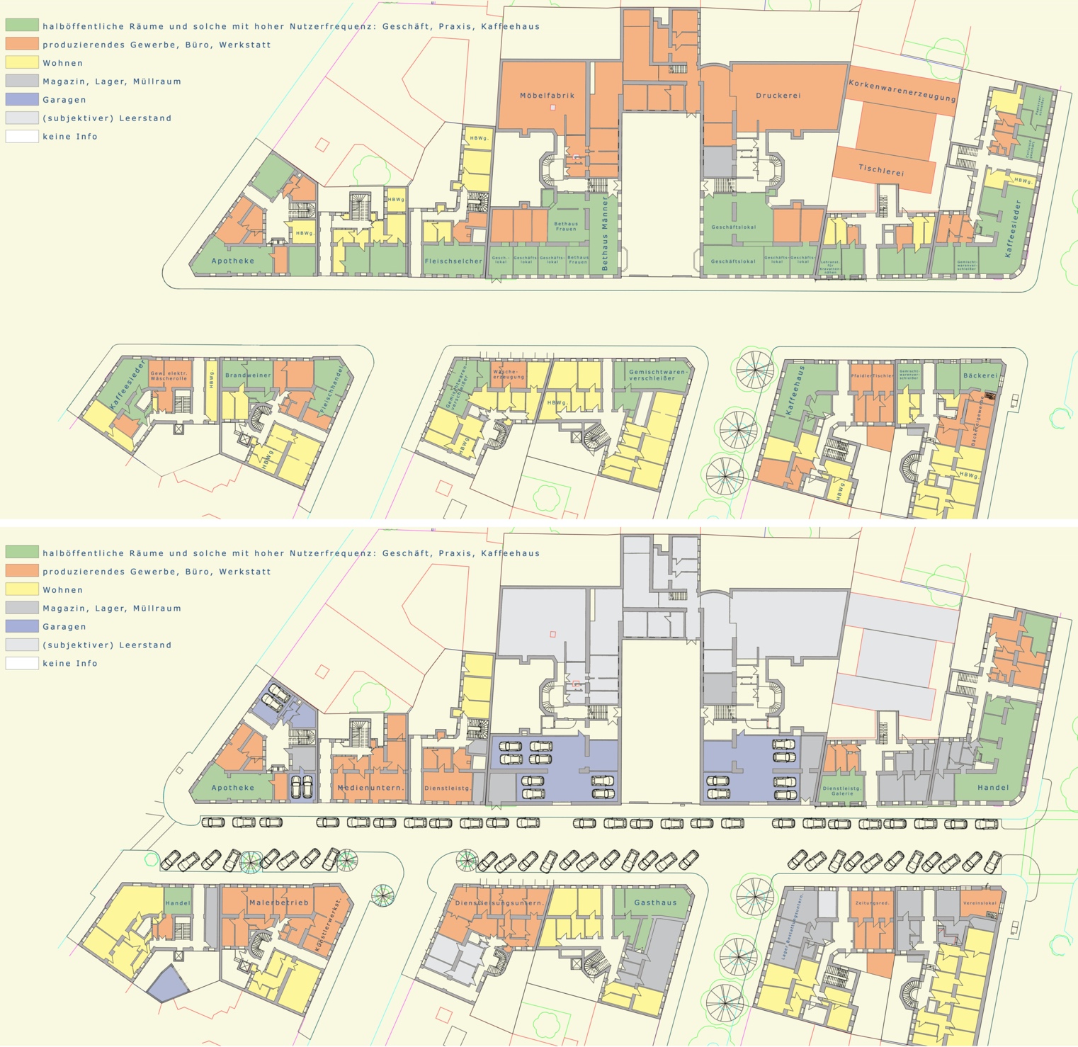
Image: Uses of the StadtParterre around 1910; below: Today’s uses of the StadtParterre. UPM; © A. Psenner 2018
Abstract
As conventional cadastral maps only show building perimeters, they contain no information about the city’s internal structure—that is, about the complex interplay of architecture and its social and economic engagement. Urban planning seems to have little consideration for what goes on inside the buildings lining a street. The method of Urban Parterre Mapping and Urban Parterre Modelling (UPM) refers to the city’s “ground floor” as a holistic urban system, covering both built-up and non-built-up areas. Street, ground floor and inner courtyard are treated as entity, which brings out the interrelations between them, as it becomes clear that actual and potential ground floor uses directly impacts the correlated public street space.
Psenner, A. “Spatial Representation of Vienna’s Street-Level Environment—Urban Parterre Modelling (UPM).” In Digital Cities: Between History and Archaeology, by H. Murteira and M. Forte, 259-278. Oxford University Press, 2020. https://publik.tuwien.ac.at/files/publik_270958.pdf DOI: 10.1093/oso/9780190498900.001.0001