
’Wiener Null’—Levelling the City of Vienna
Angelika Psenner
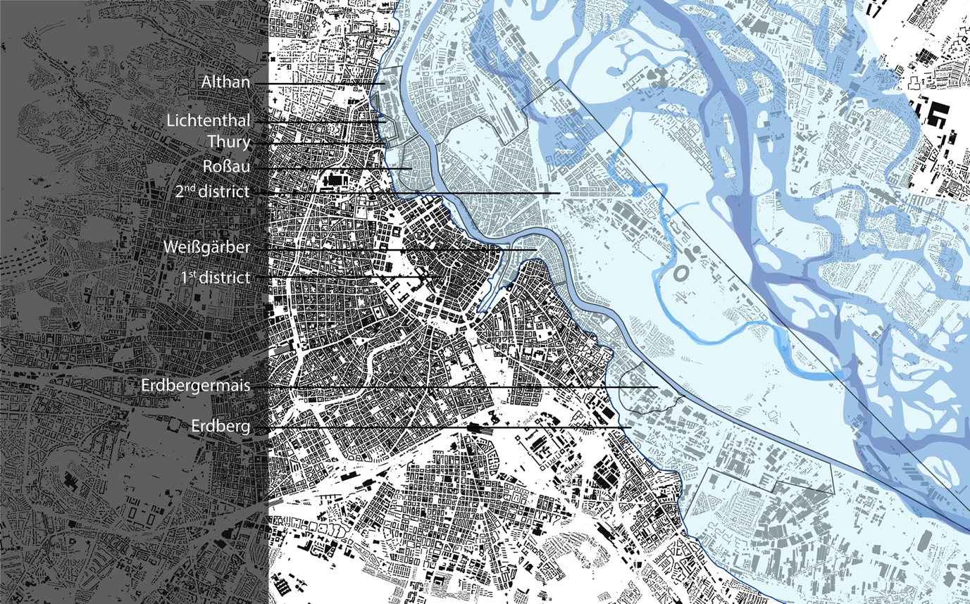
Image: Plan showing the actual figure-ground-plan of the city, as well as the original waterways of the Danube and the districts affected by the great flood of 1830. This designated area is corresponding to the height-levelling zone and the quarters mentioned in the district council policy of 1882 when specifying the ‘flood area’: 2nd district, Erdbergermais, 1st district (some areas, near Donaukanal), Erdberg, Weißgärber, Roßau, Lichtental, Thury and Althan. © Kodydek/Psenner 2018 (Sources: https://www.schwarzplan.eu/produkt/lageplan-wien/; WStLA: Perspektivkarte des Erzherzogtum Österreich u.d.E.; Hohensinner 2015, 13)
Abstract
In response to socio-economic and political changes during the 19th century Vienna—like other metropolises—experienced an extremely rapid population growth. Unlike other cities, Vienna's situation was unique because its land area was bounded by the topographic elements of the hilly Wiener Wald landscape and the marsh land of Danube River, and since the city could not easily spread, interventions such as regrading and levelling of the townscape were undertaken. Thus far, these aspects of historic urban planning have been relatively unexamined, and this paper offers some essential findings.
Grading adjustments occurred in the course of the two major city extensions and the corresponding regulation master plans after 1858 and 1893. Local grading was triggered by infrastructural installation work, and further levelling was engaged—and organised by building codes—in order to improve traffic flow and for flood mitigation. The latter became the most effective intervention as it fundamentally restructured all low-lying districts.
Psenner, A. ’Wiener Null’ – Levelling the City of Vienna. In Urban Research & Practice, Journal of the European Urban Research Association EURA, edited by Rob Atkinson, vol. 13, no.2. 131-156. 2018. http://dx.doi.org/10.1080/17535069.2018.1510025